
Thank you for supporting this site ❤️
Make a donation
Make a donation
Gear up for your next adventure:
As an Amazon Associate, this site earns from qualifying purchases at no extra cost to you.
Pattigham topographic map
Click on the map to display elevation.
Thank you for supporting this site ❤️
Make a donation
Make a donation
Gear up for your next adventure:
As an Amazon Associate, this site earns from qualifying purchases at no extra cost to you.
About this map
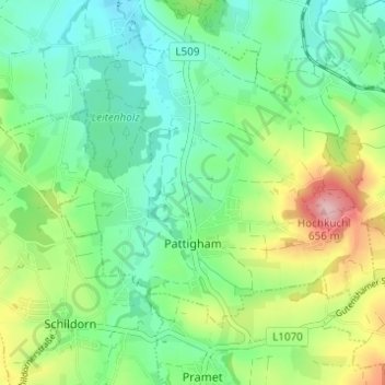
Name: Pattigham topographic map, elevation, terrain.
Location: Pattigham, Bezirk Ried, Upper Austria, 4910, Austria (48.13945 13.46320 48.18037 13.52209)
Average elevation: 521 m
Minimum elevation: 463 m
Maximum elevation: 647 m
Thank you for supporting this site ❤️
Make a donation
Make a donation
Gear up for your next adventure:
As an Amazon Associate, this site earns from qualifying purchases at no extra cost to you.