
Maqu County topographic map
Interactive map
Click on the map to display elevation.
About this map
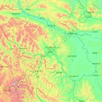
Name: Maqu County topographic map, elevation, terrain.
Location: Maqu County, Gannan, Gansu, China (33.10520 100.76286 34.38453 102.48214)
Average elevation: 3,812 m
Minimum elevation: 3,305 m
Maximum elevation: 5,295 m
Maqu County (Chinese: 玛曲县; Tibetan: རྨ་ཆུ་རྫོང་།) is a county of the Gannan Tibetan Autonomous Prefecture in the south of Gansu province of China, bordering the provinces of Sichuan to the east and southeast, and Qinghai to the southwest, west and northwest. Its postal code is 747300, and in 1999 its population was 36,213 people. The word "Maqu" derived from the Tibetan name of Yellow River. The area of Maqu County is 10,191 km2 with an average altitude of 3,700 meters. Maqu County receives high rainfall and is located at the northern edge of the Zoigê Marshes on the Yellow River where conditions are optimal for alpine meadow vegetation.
Other topographic maps
Click on a map to view its topography, its elevation and its terrain.