
Château Sainte-Anne topographic map
Interactive map
Click on the map to display elevation.
About this map
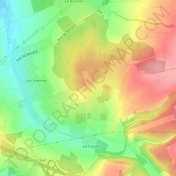
Name: Château Sainte-Anne topographic map, elevation, terrain.
Average elevation: 208 m
Minimum elevation: 149 m
Maximum elevation: 267 m
Other topographic maps
Click on a map to view its topography, its elevation and its terrain.
Égriselles
France > Bourgogne-Franche-Comté > Yonne > Venoy
Égriselles, Venoy, Auxerre, Yonne, Bourgogne-Franche-Comté, France métropolitaine, 89290, France
Average elevation: 177 m