Geolocate

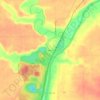
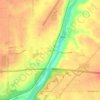
Cedar Point topographic map

Click on the map to display elevation.

About this map

Name: Cedar Point topographic map, elevation, terrain.

Location: Cedar Point, LaSalle County, Illinois, 61316, United States (41.25760 -89.13575 41.27282 -89.11633)

Average elevation: 200 m

Minimum elevation: 184 m

Maximum elevation: 207 m

Other topographic maps

Click on a map to view its topography, its elevation and its terrain.
Starved Rock

United States > Illinois > LaSalle County

Average elevation: 160 m

Wedron

United States > Illinois > LaSalle County

Average elevation: 179 m

Dayton

United States > Illinois > LaSalle County

Average elevation: 179 m

Hitt

United States > Illinois > LaSalle County > Ottawa

Average elevation: 174 m

Gear up for your next adventure:

🔋Portable Power Banks - Keep devices charged on long trips
🪓Camping Axes & Hatchets - Wood cutting tools for campsite prep
🎁Outdoor Gift Ideas - Great gifts for adventurers
🧢Hiking Hats & Caps - Protective headwear for sun and rain
🧯Portable Extinguishers - Safety tools for campfires

As an Amazon Associate, this site earns from qualifying purchases at no extra cost to you.