
Thank you for supporting this site ❤️
Make a donation
Make a donation
Gear up for your next adventure:
As an Amazon Associate, this site earns from qualifying purchases at no extra cost to you.
Tunal topographic map
Click on the map to display elevation.
Thank you for supporting this site ❤️
Make a donation
Make a donation
Gear up for your next adventure:
As an Amazon Associate, this site earns from qualifying purchases at no extra cost to you.
About this map
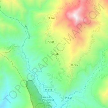
Name: Tunal topographic map, elevation, terrain.
Location: Tunal, Lalaquiz, Huancabamba, Piura, Perú (-5.25553 -79.71997 -5.17553 -79.63997)
Average elevation: 921 m
Minimum elevation: 294 m
Maximum elevation: 2,192 m
Thank you for supporting this site ❤️
Make a donation
Make a donation
Gear up for your next adventure:
As an Amazon Associate, this site earns from qualifying purchases at no extra cost to you.