
Storkenkopf topographic map
Interactive map
Click on the map to display elevation.
About this map
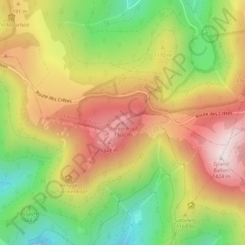
Name: Storkenkopf topographic map, elevation, terrain.
Average elevation: 1,115 m
Minimum elevation: 800 m
Maximum elevation: 1,419 m
Other topographic maps
Click on a map to view its topography, its elevation and its terrain.
Col du Haag
France > Grand Est > Lautenbachzell > Geishouse
Col du Haag, Route des Crêtes, Geishouse, Thann-Guebwiller, Haut-Rhin, Grand Est, France métropolitaine, 68690, France
Average elevation: 1,149 m