
Thank you for supporting this site ❤️
Make a donation
Make a donation
Gear up for your next adventure:
As an Amazon Associate, this site earns from qualifying purchases at no extra cost to you.
Chasquitambo topographic map
Click on the map to display elevation.
Thank you for supporting this site ❤️
Make a donation
Make a donation
Gear up for your next adventure:
As an Amazon Associate, this site earns from qualifying purchases at no extra cost to you.
About this map
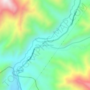
Name: Chasquitambo topographic map, elevation, terrain.
Location: Chasquitambo, Provincia de Bolognesi, Áncash, Perú (-10.33236 -77.63486 -10.29236 -77.59486)
Average elevation: 967 m
Minimum elevation: 631 m
Maximum elevation: 1,710 m
Thank you for supporting this site ❤️
Make a donation
Make a donation
Gear up for your next adventure:
As an Amazon Associate, this site earns from qualifying purchases at no extra cost to you.