Geolocate

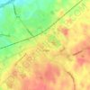
Keady topographic map

Click on the map to display elevation.

About this map
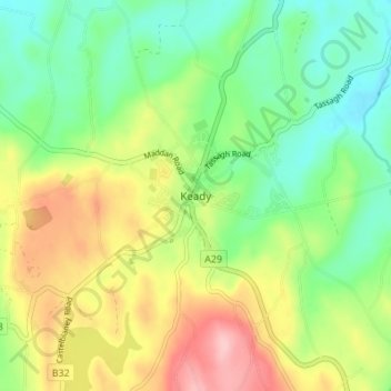
Name: Keady topographic map, elevation, terrain.

Location: Keady, Armagh City, Banbridge and Craigavon District, County Armagh, Northern Ireland, BT60 3TA, United Kingdom (54.20843 -6.74510 54.28843 -6.66510)

Average elevation: 156 m

Minimum elevation: 71 m

Maximum elevation: 280 m

Other topographic maps

Click on a map to view its topography, its elevation and its terrain.
Armagh

United Kingdom > Northern Ireland > County Armagh > Armagh

Average elevation: 100 m

Gear up for your next adventure:

🕶️Polarized Sunglasses - Reduce glare from lakes and sea cliffs
☕Vacuum Insulated Flasks - Keep tea or coffee hot for 12 hours on the summit
🧗Climbing Gear - Essential equipment for climbing routes
⌚Solar Multisport Watches - Advanced mapping and GPS tracking for endurance hikers
📷Compact Binoculars - High-definition optics for scouting terrain and wildlife

As an Amazon Associate, this site earns from qualifying purchases at no extra cost to you.