Geolocate

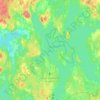
Attsjö topographic map

Click on the map to display elevation.

About this map

Name: Attsjö topographic map, elevation, terrain.

Location: Attsjö, Växjö kommun, Kronoberg County, 365 93, Sweden (56.87451 15.07163 56.91451 15.11163)

Average elevation: 219 m

Minimum elevation: 181 m

Maximum elevation: 254 m

Other topographic maps

Click on a map to view its topography, its elevation and its terrain.
Helgasjön

Sweden > Kronoberg County > Åby

Average elevation: 173 m

Växjö kommun

Sweden > Kronoberg County

Average elevation: 191 m

Lessebo kommun

Sweden > Kronoberg County

Average elevation: 178 m

Tingsryds kommun

Sweden > Kronoberg County

Average elevation: 138 m

Markaryds kommun

Sweden > Kronoberg County

Average elevation: 137 m

England

Sweden > Kronoberg County > Markaryd

Average elevation: 107 m

Gear up for your next adventure:

🔌Travel Adapters - Essential for visitors to charge gear in Ireland
🚰Hydration Packs - Hands‑free water storage for hikers
🧊Winter Boot Traction - Grip for icy paths in the Mourne or Derryveagh mountains
🧯Portable Extinguishers - Safety tools for campfires
🧴Hiking Sunscreen - Sun protection for long exposure

As an Amazon Associate, this site earns from qualifying purchases at no extra cost to you.