
Musi Rawas topographic map
Interactive map
Click on the map to display elevation.
About this map
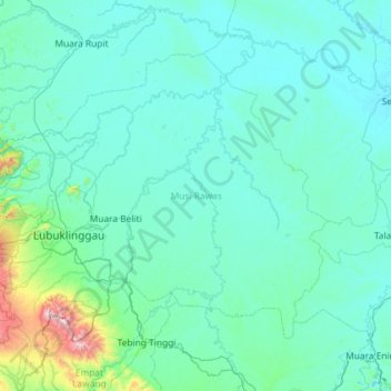
Name: Musi Rawas topographic map, elevation, terrain.
Location: Musi Rawas, Süd-Sumatra, 15131, Indonesien (-3.59794 102.48327 -2.75295 103.64387)
Average elevation: 120 m
Minimum elevation: 7 m
Maximum elevation: 1,764 m