
Boyle Municipal District topographic map
Interactive map
Click on the map to display elevation.
About this map
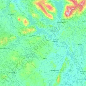
Name: Boyle Municipal District topographic map, elevation, terrain.
Location: Boyle Municipal District, County Roscommon, Connacht, Ireland (53.73304 -8.69153 54.12524 -7.87588)
Average elevation: 94 m
Minimum elevation: 26 m
Maximum elevation: 584 m
County Roscommon trails, hiking, mountain biking, running and outdoor activities
Other topographic maps
Click on a map to view its topography, its elevation and its terrain.