
Chittenden County topographic map
Interactive map
Click on the map to display elevation.
Chittenden County
The town of Underhill in Chittenden County is home to the highest summit within the state, Mount Mansfield, which has a peak elevation of 4,393 feet (1,339 m) above sea level.
About this map
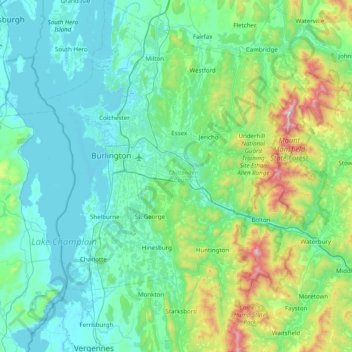
Name: Chittenden County topographic map, elevation, terrain.
Location: Chittenden County, Vermont, United States of America (44.16141 -73.36204 44.72281 -72.80238)
Average elevation: 228 m
Minimum elevation: 25 m
Maximum elevation: 1,305 m