Geolocate

Herve topographic map

Click on the map to display elevation.

About this map
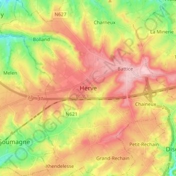
Name: Herve topographic map, elevation, terrain.

Location: Herve, Verviers, Liège, Wallonia, 4650, Belgium (50.59916 5.75310 50.67916 5.83310)

Average elevation: 256 m

Minimum elevation: 167 m

Maximum elevation: 335 m

Gear up for your next adventure:

⛺Camping Tents - Top tents for Irish weather and conditions
🎒Day Packs - Perfect packs for day trips
📱Rugged Smartphones - Waterproof phones with long battery for offline mapping
🏕️Family Camping Sets - Gear packages for family trips
🎒Waterproof Backpacks - Protect your gear from rain on Irish hikes

As an Amazon Associate, this site earns from qualifying purchases at no extra cost to you.