Geolocate

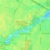
Alexis topographic map

Click on the map to display elevation.

About this map

Name: Alexis topographic map, elevation, terrain.

Location: Alexis, Toledo, Lucas County, Ohio, 43612, United States (41.70673 -83.55378 41.74673 -83.51378)

Average elevation: 183 m

Minimum elevation: 173 m

Maximum elevation: 205 m

Other topographic maps

Click on a map to view its topography, its elevation and its terrain.
Ottawa Park

United States > Ohio > Lucas County > Toledo

Average elevation: 189 m

Gear up for your next adventure:

🧴Anti-Chafe Sticks - Prevent friction during long distance walking
🦺Outdoor Safety Vests - Increase visibility and safety
🔧Bicycle Repair Kits - On‑the‑go bike maintenance tools
🕶️Polarized Sunglasses - Reduce glare from lakes and sea cliffs
🗺️Irish Road Atlases - Comprehensive physical maps for road trips and navigation

As an Amazon Associate, this site earns from qualifying purchases at no extra cost to you.