
Thank you for supporting this site ❤️
Make a donation
Make a donation
Gear up for your next adventure:
As an Amazon Associate, this site earns from qualifying purchases at no extra cost to you.
Nakuri topographic map
Click on the map to display elevation.
Thank you for supporting this site ❤️
Make a donation
Make a donation
Gear up for your next adventure:
As an Amazon Associate, this site earns from qualifying purchases at no extra cost to you.
About this map
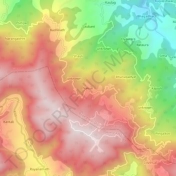
Name: Nakuri topographic map, elevation, terrain.
Location: Nakuri, Garud, Bageshwar, Uttarakhand, 263639, India (29.83840 79.56790 29.87840 79.60790)
Average elevation: 1,631 m
Minimum elevation: 1,201 m
Maximum elevation: 1,935 m
Thank you for supporting this site ❤️
Make a donation
Make a donation
Gear up for your next adventure:
As an Amazon Associate, this site earns from qualifying purchases at no extra cost to you.