
Thank you for supporting this site ❤️
Make a donation
Make a donation
Gear up for your next adventure:
As an Amazon Associate, this site earns from qualifying purchases at no extra cost to you.
Sampeyre topographic map
Click on the map to display elevation.
Thank you for supporting this site ❤️
Make a donation
Make a donation
Gear up for your next adventure:
As an Amazon Associate, this site earns from qualifying purchases at no extra cost to you.
About this map
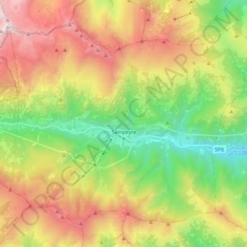
Name: Sampeyre topographic map, elevation, terrain.
Location: Sampeyre, Cuneo, Piedmont, Italy (44.53717 7.11423 44.62988 7.27442)
Average elevation: 1,720 m
Minimum elevation: 752 m
Maximum elevation: 2,981 m
Thank you for supporting this site ❤️
Make a donation
Make a donation
Gear up for your next adventure:
As an Amazon Associate, this site earns from qualifying purchases at no extra cost to you.