
Thank you for supporting this site ❤️
Make a donation
Make a donation
Gear up for your next adventure:
As an Amazon Associate, this site earns from qualifying purchases at no extra cost to you.
Samerberg topographic map
Click on the map to display elevation.
Thank you for supporting this site ❤️
Make a donation
Make a donation
Gear up for your next adventure:
As an Amazon Associate, this site earns from qualifying purchases at no extra cost to you.
About this map
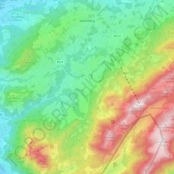
Name: Samerberg topographic map, elevation, terrain.
Location: Samerberg, Landkreis Rosenheim, Beieren, 83122, Duitsland (47.71805 12.14741 47.79147 12.25836)
Average elevation: 861 m
Minimum elevation: 462 m
Maximum elevation: 1,559 m
Thank you for supporting this site ❤️
Make a donation
Make a donation
Gear up for your next adventure:
As an Amazon Associate, this site earns from qualifying purchases at no extra cost to you.