
察布查尔县 topographic map
Interactive map
Click on the map to display elevation.
About this map
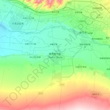
Name: 察布查尔县 topographic map, elevation, terrain.
Location: 察布查尔县, 察布查尔镇, 察布查尔锡伯自治县, 伊犁哈萨克自治州, 新疆维吾尔自治区, 中国 (43.67881 80.98928 43.99881 81.30928)
Average elevation: 665 m
Minimum elevation: 558 m
Maximum elevation: 929 m
Other topographic maps
Click on a map to view its topography, its elevation and its terrain.