
Thank you for supporting this site ❤️
Make a donation
Make a donation
Gear up for your next adventure:
As an Amazon Associate, this site earns from qualifying purchases at no extra cost to you.
Roguliat topographic map
Click on the map to display elevation.
Thank you for supporting this site ❤️
Make a donation
Make a donation
Gear up for your next adventure:
As an Amazon Associate, this site earns from qualifying purchases at no extra cost to you.
About this map
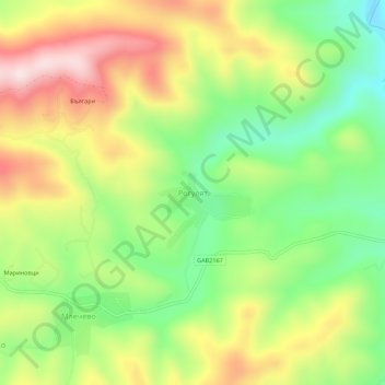
Name: Roguliat topographic map, elevation, terrain.
Location: Roguliat, Mlechevo, Sevlievo, Gabrovo, 5439, Bulgaria (42.90708 24.91045 42.94708 24.95045)
Average elevation: 478 m
Minimum elevation: 298 m
Maximum elevation: 696 m
Thank you for supporting this site ❤️
Make a donation
Make a donation
Gear up for your next adventure:
As an Amazon Associate, this site earns from qualifying purchases at no extra cost to you.