
Grimbergen topographic map
Interactive map
Click on the map to display elevation.
About this map
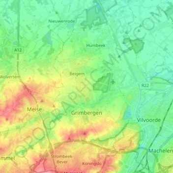
Name: Grimbergen topographic map, elevation, terrain.
Location: Grimbergen, Halle-Vilvoorde, Flemish Brabant, Flanders, Belgium (50.90094 4.31834 50.99066 4.42640)
Average elevation: 25 m
Minimum elevation: 0 m
Maximum elevation: 77 m