
Thank you for supporting this site ❤️
Make a donation
Make a donation
Gear up for your next adventure:
As an Amazon Associate, this site earns from qualifying purchases at no extra cost to you.
Melbost topographic map
Click on the map to display elevation.
Thank you for supporting this site ❤️
Make a donation
Make a donation
Gear up for your next adventure:
As an Amazon Associate, this site earns from qualifying purchases at no extra cost to you.
About this map
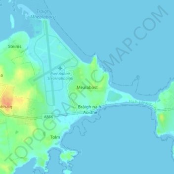
Name: Melbost topographic map, elevation, terrain.
Location: Melbost, Western Isles, Scotland, HS2 0BB, United Kingdom (58.18997 -6.33475 58.22997 -6.29475)
Average elevation: 4 m
Minimum elevation: -1 m
Maximum elevation: 35 m
Thank you for supporting this site ❤️
Make a donation
Make a donation
Gear up for your next adventure:
As an Amazon Associate, this site earns from qualifying purchases at no extra cost to you.