
Whalley topographic map
Interactive map
Click on the map to display elevation.
About this map
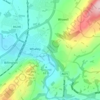
Name: Whalley topographic map, elevation, terrain.
Location: Whalley, Ribble Valley, Lancashire, Angleterre, Royaume-Uni (53.80241 -2.43494 53.83969 -2.37457)
Average elevation: 95 m
Minimum elevation: 38 m
Maximum elevation: 250 m