
Thank you for supporting this site ❤️
Make a donation
Make a donation
Gear up for your next adventure:
As an Amazon Associate, this site earns from qualifying purchases at no extra cost to you.
Llacuabamba topographic map
Click on the map to display elevation.
Thank you for supporting this site ❤️
Make a donation
Make a donation
Gear up for your next adventure:
As an Amazon Associate, this site earns from qualifying purchases at no extra cost to you.
About this map
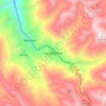
Name: Llacuabamba topographic map, elevation, terrain.
Location: Llacuabamba, Parcoy, Pataz, La Libertad, Perú (-8.07238 -77.49719 -7.99238 -77.41719)
Average elevation: 3,726 m
Minimum elevation: 2,542 m
Maximum elevation: 4,586 m
Thank you for supporting this site ❤️
Make a donation
Make a donation
Gear up for your next adventure:
As an Amazon Associate, this site earns from qualifying purchases at no extra cost to you.