Geolocate

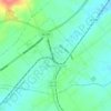
Locust Grove topographic map

Click on the map to display elevation.

About this map

Name: Locust Grove topographic map, elevation, terrain.

Location: Locust Grove, Orange County, Virginia, 22508, United States (38.28518 -77.83026 38.32518 -77.79026)

Average elevation: 128 m

Minimum elevation: 98 m

Maximum elevation: 150 m

Other topographic maps

Click on a map to view its topography, its elevation and its terrain.
Gordonsville

United States > Virginia > Orange County

Average elevation: 153 m

201 District

United States > Virginia > Orange County

Average elevation: 123 m

Gear up for your next adventure:

🕶️Polarized Sunglasses - Reduce glare from lakes and sea cliffs
🌲Survival Gear - Equipment for outdoor survival situations
🔥Camping Stoves - Portable camping stoves for outdoor cooking
🎒Hiking Backpacks - Durable backpacks for day hikes and multi‑day treks
🎒Backpack Rain Covers - Extra protection for non-waterproof rucksacks

As an Amazon Associate, this site earns from qualifying purchases at no extra cost to you.