
免渡河农场 topographic map
Interactive map
Click on the map to display elevation.
About this map
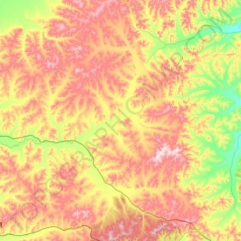
Name: 免渡河农场 topographic map, elevation, terrain.
Location: 免渡河农场, Yakeshi City, Hulunbuir, Inner Mongolia, China (48.81273 121.52686 49.44768 122.04665)
Average elevation: 890 m
Minimum elevation: 609 m
Maximum elevation: 1,299 m
Other topographic maps
Click on a map to view its topography, its elevation and its terrain.
Horqi
China > Inner Mongolia > Hulunbuir
Horqi, Arun Banner, Hulunbuir, Inner Mongolia, China
Average elevation: 358 m