Geolocate

Jülich topographic map

Click on the map to display elevation.

About this map
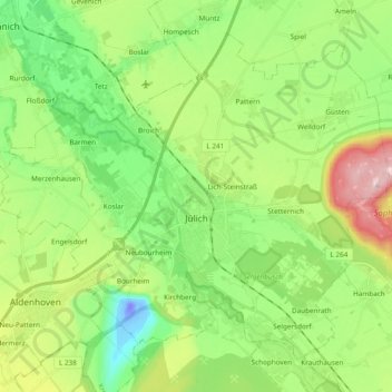
Name: Jülich topographic map, elevation, terrain.

Location: Jülich, Kreis Düren, North Rhine-Westphalia, 52428, Germany (50.87850 6.26449 50.97854 6.45489)

Average elevation: 98 m

Minimum elevation: -50 m

Maximum elevation: 291 m

Other topographic maps

Click on a map to view its topography, its elevation and its terrain.

Ellen

Germany > North Rhine-Westphalia > Kreis Düren

Average elevation: 119 m

Hambach

Germany > North Rhine-Westphalia > Kreis Düren

Average elevation: 111 m

Pier

Germany > North Rhine-Westphalia > Kreis Düren

Average elevation: 159 m

Gear up for your next adventure:

🌲Bushcraft Skills Books - Learn navigation, fire-making, and shelter building
🧺Collapsible Camp Bowls - Save space in your expedition kit
🥛Insulated Flasks - Keep drinks hot or cold
🔭Laser Distance Meters - Professional precision measuring for site surveys
📱Rugged Smartphones - Waterproof phones with long battery for offline mapping

As an Amazon Associate, this site earns from qualifying purchases at no extra cost to you.