Geolocate

Peyia topographic map

Click on the map to display elevation.

About this map

Name: Peyia topographic map, elevation, terrain.

Location: Peyia, Δήμος Ακάμα, Paphos District, Cyprus (34.84405 32.31336 34.94463 32.41296)

Average elevation: 271 m

Minimum elevation: 0 m

Maximum elevation: 687 m

Other topographic maps

Click on a map to view its topography, its elevation and its terrain.
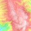
Kathikas

Cyprus > Cyprus > Δήμος Ακάμα > Kathikas

Average elevation: 579 m

Gear up for your next adventure:

🧤Thermal Gloves - Warm gloves for cold weather
🔦High-Lumen Headlamps - Hands-free lighting for early starts or late finishes
📚Irish Walking Guides - The best mapped trails in Wicklow, Kerry, and Connemara
📍Trail Markers & GPS - Tools to track and mark trails
☕Vacuum Insulated Flasks - Keep tea or coffee hot for 12 hours on the summit

As an Amazon Associate, this site earns from qualifying purchases at no extra cost to you.