
Thank you for supporting this site ❤️
Make a donation
Make a donation
Gear up for your next adventure:
As an Amazon Associate, this site earns from qualifying purchases at no extra cost to you.
Shadoxhurst topographic map
Click on the map to display elevation.
Thank you for supporting this site ❤️
Make a donation
Make a donation
Gear up for your next adventure:
As an Amazon Associate, this site earns from qualifying purchases at no extra cost to you.
About this map
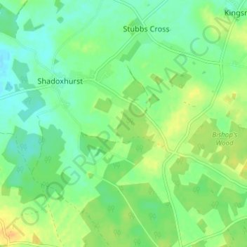
Name: Shadoxhurst topographic map, elevation, terrain.
Location: Shadoxhurst, Ashford, Kent, England, United Kingdom (51.08325 0.79816 51.11918 0.85912)
Average elevation: 43 m
Minimum elevation: 31 m
Maximum elevation: 59 m
Thank you for supporting this site ❤️
Make a donation
Make a donation
Gear up for your next adventure:
As an Amazon Associate, this site earns from qualifying purchases at no extra cost to you.