
Thank you for supporting this site ❤️
Make a donation
Make a donation
Gear up for your next adventure:
As an Amazon Associate, this site earns from qualifying purchases at no extra cost to you.
Cartavio topographic map
Click on the map to display elevation.
Thank you for supporting this site ❤️
Make a donation
Make a donation
Gear up for your next adventure:
As an Amazon Associate, this site earns from qualifying purchases at no extra cost to you.
About this map
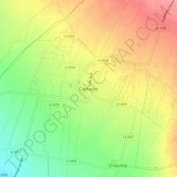
Name: Cartavio topographic map, elevation, terrain.
Location: Cartavio, Santiago de Cao, Ascope, La Libertad, Perú (-7.93261 -79.26151 -7.85261 -79.18151)
Average elevation: 56 m
Minimum elevation: 16 m
Maximum elevation: 96 m
Thank you for supporting this site ❤️
Make a donation
Make a donation
Gear up for your next adventure:
As an Amazon Associate, this site earns from qualifying purchases at no extra cost to you.