Geolocate

Golden topographic map

Click on the map to display elevation.

About this map

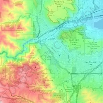
Name: Golden topographic map, elevation, terrain.

Location: Golden, Jefferson County, Colorado, United States (39.70061 -105.24196 39.78711 -105.16186)

Average elevation: 1,936 m

Minimum elevation: 1,673 m

Maximum elevation: 2,415 m

Gear up for your next adventure:

🍖Freeze-Dried Trail Meals - Nutritious and lightweight food for expeditions
🗺️Topographic Maps - Detailed maps for hiking, cycling and planning routes
🛌3-Season Sleeping Bags - Comfortable insulation for Irish spring and autumn nights
🌿Irish Flora Guides - Identify plants while exploring the countryside
🏃‍♀️Running Hydration Belts - Hydration on the go for runners

As an Amazon Associate, this site earns from qualifying purchases at no extra cost to you.