Geolocate

Tittakudi topographic map

Interactive map

Click on the map to display elevation.

About this map

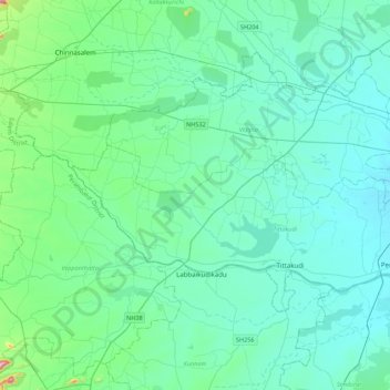
Name: Tittakudi topographic map, elevation, terrain.

Location: Tittakudi, Cuddalore District, Tamil Nadu, India (11.35086 78.87761 11.53427 79.31318)

Average elevation: 79 m

Minimum elevation: 29 m

Maximum elevation: 215 m

Other topographic maps

Click on a map to view its topography, its elevation and its terrain.

Pillaipakkam

India > Tamil Nadu

Average elevation: 31 m

Kameswaram

India > Tamil Nadu > Kilvelur

Average elevation: 2 m

Nellikuppam

India > Tamil Nadu > Chengalpattu

Average elevation: 32 m

Boys Company

India > Tamil Nadu > Coonoor

Average elevation: 1,881 m

Pykara

India > Tamil Nadu > Udhagamandalam

Average elevation: 2,104 m

Pudukkottai

India > Tamil Nadu > Pudukkottai taluk

Average elevation: 96 m