
Make a donation
Gear up for your next adventure:
As an Amazon Associate, this site earns from qualifying purchases at no extra cost to you.
Hoffman Notch Wilderness topographic map
Click on the map to display elevation.
Make a donation
Gear up for your next adventure:
As an Amazon Associate, this site earns from qualifying purchases at no extra cost to you.
Hoffman Notch Wilderness
The forest cover ranges from second growth hardwoods of sapling and pole-size to nearly solid conifer stands of near mature size at the higher elevations. On some of the better soil, exceptionally large diameter hardwoods occur.
Make a donation
Gear up for your next adventure:
As an Amazon Associate, this site earns from qualifying purchases at no extra cost to you.
About this map
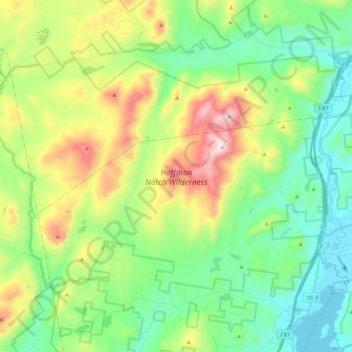
Name: Hoffman Notch Wilderness topographic map, elevation, terrain.
Average elevation: 515 m
Minimum elevation: 242 m
Maximum elevation: 1,108 m
Make a donation
Gear up for your next adventure:
As an Amazon Associate, this site earns from qualifying purchases at no extra cost to you.