
Thank you for supporting this site ❤️
Make a donation
Make a donation
Gear up for your next adventure:
As an Amazon Associate, this site earns from qualifying purchases at no extra cost to you.
Nicanor topographic map
Click on the map to display elevation.
Thank you for supporting this site ❤️
Make a donation
Make a donation
Gear up for your next adventure:
As an Amazon Associate, this site earns from qualifying purchases at no extra cost to you.
About this map
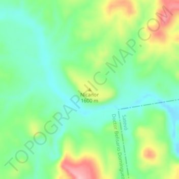
Name: Nicanor topographic map, elevation, terrain.
Location: Nicanor, Dr. Belisario Domínguez, Chihuahua, Mexico (28.10431 -106.38533 28.10441 -106.38523)
Average elevation: 1,577 m
Minimum elevation: 1,526 m
Maximum elevation: 1,674 m
Thank you for supporting this site ❤️
Make a donation
Make a donation
Gear up for your next adventure:
As an Amazon Associate, this site earns from qualifying purchases at no extra cost to you.