
Stanley County topographic map
Interactive map
Click on the map to display elevation.
About this map
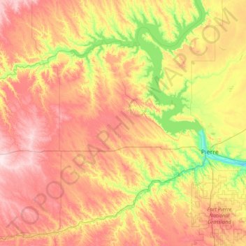
Name: Stanley County topographic map, elevation, terrain.
Location: Stanley County, Dakota del Sur, Estados Unidos (44.16828 -101.17060 44.78265 -99.89050)
Average elevation: 584 m
Minimum elevation: 429 m
Maximum elevation: 787 m
Other topographic maps
Click on a map to view its topography, its elevation and its terrain.
Spearfish
Estados Unidos > Dakota del Sur > Spearfish
Spearfish, Lawrence County, Dakota del Sur, Estados Unidos
Average elevation: 1,171 m