
Thank you for supporting this site ❤️
Make a donation
Make a donation
Gear up for your next adventure:
As an Amazon Associate, this site earns from qualifying purchases at no extra cost to you.
Jají topographic map
Click on the map to display elevation.
Thank you for supporting this site ❤️
Make a donation
Make a donation
Gear up for your next adventure:
As an Amazon Associate, this site earns from qualifying purchases at no extra cost to you.
About this map
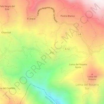
Name: Jají topographic map, elevation, terrain.
Location: Jají, Parroquia Jají, Municipio Campo Elias, Venezuela (8.55228 -71.36126 8.59228 -71.32126)
Average elevation: 1,870 m
Minimum elevation: 1,273 m
Maximum elevation: 2,390 m
Thank you for supporting this site ❤️
Make a donation
Make a donation
Gear up for your next adventure:
As an Amazon Associate, this site earns from qualifying purchases at no extra cost to you.