
Chordeleg topographic map
Interactive map
Click on the map to display elevation.
About this map
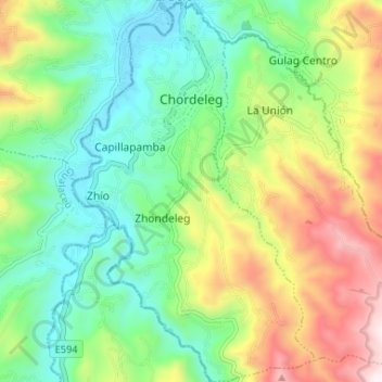
Name: Chordeleg topographic map, elevation, terrain.
Location: Chordeleg, Azuay, 010404, Equador (-2.97069 -78.79656 -2.90544 -78.75501)
Average elevation: 2,517 m
Minimum elevation: 2,230 m
Maximum elevation: 3,041 m