
Thank you for supporting this site ❤️
Make a donation
Make a donation
Gear up for your next adventure:
As an Amazon Associate, this site earns from qualifying purchases at no extra cost to you.
Tali topographic map
Click on the map to display elevation.
Thank you for supporting this site ❤️
Make a donation
Make a donation
Gear up for your next adventure:
As an Amazon Associate, this site earns from qualifying purchases at no extra cost to you.
About this map
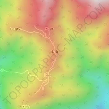
Name: Tali topographic map, elevation, terrain.
Location: Tali, Tali ADC, Kra Daadi District, Arunachal Pradesh, India (28.01662 93.75003 28.02362 93.75314)
Average elevation: 1,102 m
Minimum elevation: 539 m
Maximum elevation: 1,611 m
Thank you for supporting this site ❤️
Make a donation
Make a donation
Gear up for your next adventure:
As an Amazon Associate, this site earns from qualifying purchases at no extra cost to you.