
Make a donation
Gear up for your next adventure:
As an Amazon Associate, this site earns from qualifying purchases at no extra cost to you.
Rivière Langevin topographic map
Click on the map to display elevation.
Make a donation
Gear up for your next adventure:
As an Amazon Associate, this site earns from qualifying purchases at no extra cost to you.
Rivière Langevin
De 18,3 km de longueur, la rivière Langevin prend sa source à 2 200 m d'altitude, près du piton Chisny (2 439 m). Elle s'appelle aussi le Bras Ouvrange de Grand Sable jusqu'à 850 m d'altitude environ, près du captage de Pointe de l'Ilet et des Cascades La Fouillée, puis la Grande Ravine jusqu'à environ 600 m d'altitude.
Make a donation
Gear up for your next adventure:
As an Amazon Associate, this site earns from qualifying purchases at no extra cost to you.
About this map
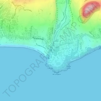
Name: Rivière Langevin topographic map, elevation, terrain.
Average elevation: 52 m
Minimum elevation: 0 m
Maximum elevation: 284 m
Make a donation
Gear up for your next adventure:
As an Amazon Associate, this site earns from qualifying purchases at no extra cost to you.