
Buckfastleigh topographic map
Interactive map
Click on the map to display elevation.
About this map
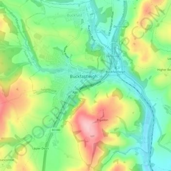
Name: Buckfastleigh topographic map, elevation, terrain.
Average elevation: 85 m
Minimum elevation: 18 m
Maximum elevation: 189 m
Other topographic maps
Click on a map to view its topography, its elevation and its terrain.
Liverton
United Kingdom > England > Teignbridge > Liverton
Liverton, Teignbridge, Devon, South West England, England, TQ12 6HN, United Kingdom
Average elevation: 91 m