Geolocate

Akeley topographic map

Click on the map to display elevation.

About this map

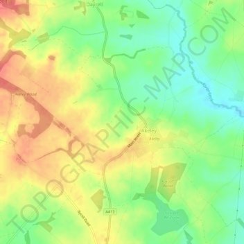
Name: Akeley topographic map, elevation, terrain.

Location: Akeley, Buckinghamshire, England, United Kingdom (52.02326 -1.00198 52.04600 -0.94796)

Average elevation: 113 m

Minimum elevation: 83 m

Maximum elevation: 143 m

Other topographic maps

Click on a map to view its topography, its elevation and its terrain.

Iver Heath

United Kingdom > England > Buckinghamshire

Average elevation: 50 m

Hazlemere

United Kingdom > England > Buckinghamshire

Average elevation: 166 m

Gear up for your next adventure:

💨Windbreakers - Protection from strong winds
📱Rugged Smartphones - Waterproof phones with long battery for offline mapping
🗺️Topographic Maps - Detailed maps for hiking, cycling and planning routes
🛰️Handheld GPS Units - Professional satellite navigation for Irish highlands
🚨Emergency Whistles - Safety whistles for hikers

As an Amazon Associate, this site earns from qualifying purchases at no extra cost to you.