Geolocate

Denholme topographic map

Click on the map to display elevation.

About this map

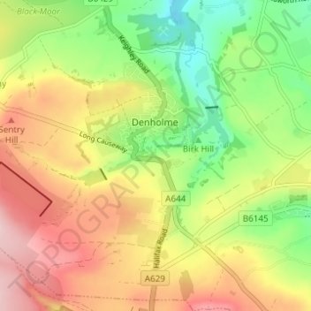
Name: Denholme topographic map, elevation, terrain.

Location: Denholme, Bradford, West Yorkshire, England, United Kingdom (53.78088 -1.92854 53.81468 -1.86693)

Average elevation: 312 m

Minimum elevation: 209 m

Maximum elevation: 421 m

Gear up for your next adventure:

📖Outdoor Guide Books - Expert guides for Irish nature
📸Travel Camera Tripods - Steady shots for landscape and long-exposure photos
🎒Technical Hiking Daypacks - Ergonomic backpacks with hydration bladder compatibility
🛌Cold Weather Sleeping Bags - Warm sleeping bags for colder hikes
🧥Waterproof Hiking Jackets - Rain jackets for unpredictable weather

As an Amazon Associate, this site earns from qualifying purchases at no extra cost to you.