
San Pedro topographic map
Interactive map
Click on the map to display elevation.
About this map
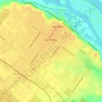
Name: San Pedro topographic map, elevation, terrain.
Location: San Pedro, Partido de San Pedro, Bs. As., Argentinien (-33.70688 -59.68978 -33.66492 -59.64499)
Average elevation: 22 m
Minimum elevation: -2 m
Maximum elevation: 33 m