
Huangpu District topographic map
Interactive map
Click on the map to display elevation.
About this map
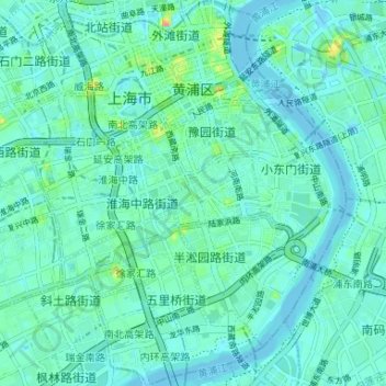
Name: Huangpu District topographic map, elevation, terrain.
Location: Huangpu District, Shanghai, China (31.19020 121.45220 31.24631 121.50596)
Average elevation: 9 m
Minimum elevation: -6 m
Maximum elevation: 49 m
Other topographic maps
Click on a map to view its topography, its elevation and its terrain.
People's Park
People's Park, 同益里, Nanjingdonglu Subdistrict, Huangpu District, Shanghai, 200001, China
Average elevation: 11 m
Waitan Subdistrict
Waitan Subdistrict, Huangpu District, Shanghai, China
Average elevation: 11 m