
Thank you for supporting this site ❤️
Make a donation
Make a donation
Gear up for your next adventure:
As an Amazon Associate, this site earns from qualifying purchases at no extra cost to you.
Dundalk topographic map
Click on the map to display elevation.
Thank you for supporting this site ❤️
Make a donation
Make a donation
Gear up for your next adventure:
As an Amazon Associate, this site earns from qualifying purchases at no extra cost to you.
About this map
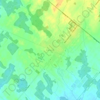
Name: Dundalk topographic map, elevation, terrain.
Location: Dundalk, Southgate, Grey County, Ontario, N0C 1B0, Canada (44.14915 -80.41658 44.18915 -80.37658)
Average elevation: 516 m
Minimum elevation: 503 m
Maximum elevation: 535 m
Thank you for supporting this site ❤️
Make a donation
Make a donation
Gear up for your next adventure:
As an Amazon Associate, this site earns from qualifying purchases at no extra cost to you.