
Dundalk Poor Law Union topographic map
Interactive map
Click on the map to display elevation.
About this map
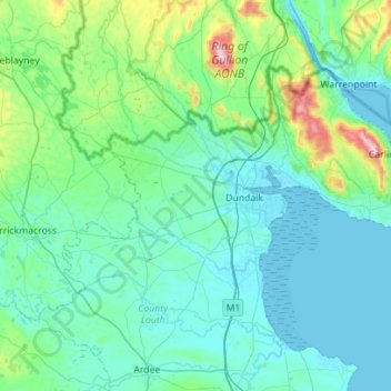
Name: Dundalk Poor Law Union topographic map, elevation, terrain.
Location: Dundalk Poor Law Union, County Louth, Leinster, Ireland (53.89765 -6.66219 54.11395 -6.10324)
Average elevation: 74 m
Minimum elevation: -1 m
Maximum elevation: 580 m
County Louth trails, hiking, mountain biking, running and outdoor activities
Other topographic maps
Click on a map to view its topography, its elevation and its terrain.