
Villa Borghese topographic map
Interactive map
Click on the map to display elevation.
About this map
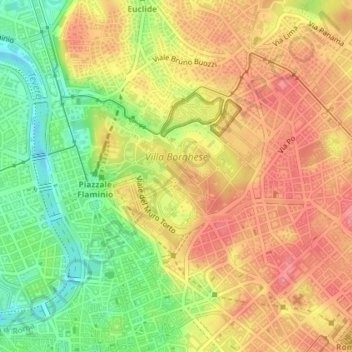
Name: Villa Borghese topographic map, elevation, terrain.
Location: Villa Borghese, Municipio Roma II, Rom, RM, Latium, Italien (41.90883 12.47393 41.91970 12.49313)
Average elevation: 51 m
Minimum elevation: 7 m
Maximum elevation: 85 m
Other topographic maps
Click on a map to view its topography, its elevation and its terrain.
Municipio Roma VII
Municipio Roma VII, Rom, RM, Latium, Italien
Average elevation: 83 m
Municipio Roma I
Municipio Roma I, Rom, RM, Latium, Italien
Average elevation: 51 m