Geolocate

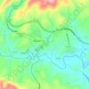
Woolwine topographic map

Click on the map to display elevation.

About this map

Name: Woolwine topographic map, elevation, terrain.

Location: Woolwine, Patrick County, Virginia, 24185, United States (36.76986 -80.29728 36.80986 -80.25728)

Average elevation: 454 m

Minimum elevation: 376 m

Maximum elevation: 647 m

Other topographic maps

Click on a map to view its topography, its elevation and its terrain.

Stuart

United States > Virginia > Patrick County

Average elevation: 411 m

Stuart

United States > Virginia > Patrick County

Average elevation: 411 m

Stuart

United States > Virginia > Patrick County

Average elevation: 416 m

Gear up for your next adventure:

🚶‍♂️Trekking Poles - Supportive poles for stability on varied terrain
🛰️Handheld GPS Units - Professional satellite navigation for Irish highlands
📸Travel Camera Tripods - Steady shots for landscape and long-exposure photos
🥾Lightweight Hiking Shoes - Light, breathable shoes for trail walking
🪶Ultralight Tents - Lightweight shelters for hikers

As an Amazon Associate, this site earns from qualifying purchases at no extra cost to you.