
Thank you for supporting this site ❤️
Make a donation
Make a donation
Gear up for your next adventure:
As an Amazon Associate, this site earns from qualifying purchases at no extra cost to you.
Sigüenza topographic map
Click on the map to display elevation.
Thank you for supporting this site ❤️
Make a donation
Make a donation
Gear up for your next adventure:
As an Amazon Associate, this site earns from qualifying purchases at no extra cost to you.
About this map
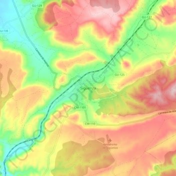
Name: Sigüenza topographic map, elevation, terrain.
Location: Sigüenza, Guadalajara, Castile-La Mancha, 19250, Spain (41.02803 -2.68057 41.10803 -2.60057)
Average elevation: 1,072 m
Minimum elevation: 934 m
Maximum elevation: 1,203 m
Thank you for supporting this site ❤️
Make a donation
Make a donation
Gear up for your next adventure:
As an Amazon Associate, this site earns from qualifying purchases at no extra cost to you.