
Thank you for supporting this site ❤️
Make a donation
Make a donation
Gear up for your next adventure:
As an Amazon Associate, this site earns from qualifying purchases at no extra cost to you.
Rakovica topographic map
Click on the map to display elevation.
Thank you for supporting this site ❤️
Make a donation
Make a donation
Gear up for your next adventure:
As an Amazon Associate, this site earns from qualifying purchases at no extra cost to you.
About this map
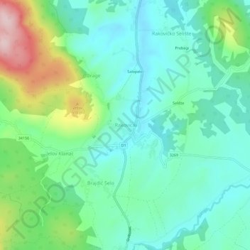
Name: Rakovica topographic map, elevation, terrain.
Location: Rakovica, Općina Rakovica, Karlovac County, 47245, Croatia (44.97473 15.62828 45.01473 15.66828)
Average elevation: 401 m
Minimum elevation: 329 m
Maximum elevation: 596 m
Thank you for supporting this site ❤️
Make a donation
Make a donation
Gear up for your next adventure:
As an Amazon Associate, this site earns from qualifying purchases at no extra cost to you.