Geolocate

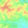
Newent topographic map

Click on the map to display elevation.

About this map

Name: Newent topographic map, elevation, terrain.

Location: Newent, Forest of Dean, Gloucestershire, England, United Kingdom (51.88396 -2.44646 51.96331 -2.34314)

Average elevation: 54 m

Minimum elevation: 8 m

Maximum elevation: 303 m

Other topographic maps

Click on a map to view its topography, its elevation and its terrain.
Gear up for your next adventure:

🥾Men's Waterproof Boots - Sturdy footwear for wet and boggy Irish terrain
🦺Outdoor Safety Vests - Increase visibility and safety
🥽UV Protection Sunglasses - Protect eyes on bright days
🧿Outdoor Gadgets - Innovative tools for outdoor enthusiasts
🪓Camping Axes & Hatchets - Wood cutting tools for campsite prep

As an Amazon Associate, this site earns from qualifying purchases at no extra cost to you.